Sonoma County LiDAR and 2013 Orthos Available
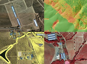 Land managers, planners, engineers, and geogeeks will be glad to hear that - for the first time ever - Sonoma County has complete countywide LiDAR data! These data, which include the point cloud, numerous raster deliverables, and simultaneously collected 4-band, 6-inch orthophotography are the first deliverables of the Sonoma County Vegetation Mapping and LiDAR Program (Sonoma Veg Map). The data are free and publicly available. Go to http://sonomavegmap.org for info and details.